Geographic Information Systems (GIS) has transformed from a niche technical field into an essential tool across urban planning, environmental science, logistics, and data analytics. Mastering a few fundamental concepts and tools will give you a solid foundation to start analyzing spatial data and building maps.
1. Understand GIS Fundamentals
Before jumping into advanced tools, understand the basics of GIS. Learn about spatial data, layers, coordinates, projections, scale, attributes, and spatial relationships.
2. Learn a GIS Software
Hands-on experience with GIS software is essential. Start with a platform such as QGIS or ArcGIS and become comfortable with its basic tools.
Learn how to:
Create and manage layers
Add and edit spatial data
Symbolize features
Label map features
Use attribute tables
Perform basic spatial analysis
Create professional maps
Export maps and data
3. Master Coordinate Reference Systems
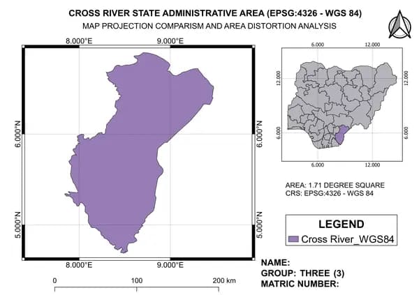
Coordinates are at the heart of GIS.Learn about latitude and longitude, coordinate reference systems (CRS), geographic vs. projected coordinate systems, and EPSG codes.
You should also understand why choosing the correct CRS matters when displaying, measuring, or analyzing spatial data.
4. Develop Data Management Skills
A large part of GIS work involves finding, cleaning, organizing, and managing spatial data.
Learn how to work with common formats such as:
Shapefiles
GeoJSON
GeoPackage
CSV
GeoTIFF
KML/KMZ
5. Learn Basic Spatial Analysis
To learn spatial analysis begin with simple tools such as:
Buffer → Clip → Intersect → Dissolve → Merge → Spatial Join → Select by Location
These tools form the foundation of many real-world GIS workflows. For example, you might use a buffer to identify schools within 2 km of a road or a spatial join to connect demographic information with administrative boundaries.
6. Improve Your Mapping Skills
A good GIS professional should be able to communicate information visually.
Learn the principles of cartography and map design, including:
Appropriate symbols
Color selection
Labels
Scale bars
North arrows
Legends
Titles
Data classification
A technically correct map can still be difficult to understand if it is poorly designed.
7. Get Comfortable with Geocoding
Geocoding is an extremely useful practical skill.
It allows you to convert addresses or place names into geographic coordinates so they can be displayed and analyzed on a map. Reverse geocoding works in the opposite direction by converting coordinates into addresses or locations. Learning geocoding can be particularly useful for projects involving businesses, customers, facilities, transportation, and location analysis.
8. Learn Basic Remote Sensing
You don't need to become a remote sensing expert immediately, but understanding the fundamentals can significantly expand your GIS skills. Start with concepts such as satellite imagery, spectral bands, resolution, NDVI, image classification, and raster analysis. This can open opportunities in agriculture, environmental monitoring, urban planning, disaster management, and land-use analysis.
9. Learn Some SQL and Python
Once you've developed your basic GIS skills, consider learning SQL and Python. SQL can help you work efficiently with spatial databases and large datasets. Python can help automate repetitive GIS tasks, process data, perform analysis, and create efficient workflows. You don't need to become a professional programmer. Even basic scripting knowledge can give you a major advantage.
10. Build Real Projects
Perhaps the most important step is practice. Instead of only watching tutorials, create small GIS projects. Like Map population distribution, Perform a road accessibility analysis, Geocode a list of locations.
GIS is a continuously evolving field, and the professionals who keep learning and adapting will have the strongest opportunities. Start with the basics, build your confidence, and let your skills grow one project at a time.
The key is to learn → practice → build projects → improve.