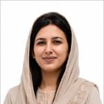
arhoz gudia
GIS & Remote Sensing Specialist
About
Experience
GIS & Remote Sensing Specialist
GLOF II Project · contract
Jan 2023 – Jun 2023 · 5 mos · Gilgit-Baltistan, Pakistan
Worked on web GIS and GIS/remote sensing project tasks Performed data analysis using Jupyter Notebook
GIS Intern
Circuit Tourism Map Project · contract
Jan 2022 – Mar 2022 · 2 mos · Gilgit-Baltistan, Pakistan
Produced tourism mapping using Google Earth Pro and OpenStreetMap Contributed Volunteered Geographic Information (VGI) data Assisted in the lab and guided undergraduate students through GIS tasks
Visiting Faculty
Karakoram International University · part time
Jan 2023 – Present · 3 yrs 10 mos · Gilgit, Pakistan
Taught and supported GIS coursework for undergraduate students
GIS Intern
Aga Khan Agency for Habitat (AKAH) Pakistan · internship
Jan 2022 – Dec 2022 · 11 mos · Gilgit, Pakistan
Digitized rock glaciers using Google Earth Engine Worked on temperature data updates Contributed to a paper on the inventory of rock glaciers in Hunza Analysed land cover change in Gahkuch
GIS Intern
Agriculture Department, Gilgit-Baltistan · internship
Jan 2022 – Dec 2022 · 11 mos · Gilgit, Pakistan
Formatted and prepared data for analysis Carried out land use/land cover analysis and other agriculture-based analyses Worked with DEMs to study elevation ranges of different fruits and vegetables
GIS Intern
Gilgit-Baltistan Monitoring Cell · internship
Jan 2021 – Mar 2021 · 2 mos · Gilgit, Pakistan
Worked with Google Earth Pro and OpenStreetMap, including VGI mapping Supported database management (DBMS) tasks and installed GIS software Guided undergraduate students through GIS tasks
Projects & Portfolio
Assessment of road health using drone data through machine learning
Thesis project focused on evaluating road conditions using drone-collected imagery and machine learning techniques.
Circuit Tourism Map Project
Developed tourism maps using Google Earth Pro and OpenStreetMap, incorporating VGI data.
Rock Glacier Inventory in Hunza
Digitized rock glaciers using Google Earth Engine and contributed to a published paper.
Land Cover Change Analysis in Gahkuch
Conducted land cover change detection analysis in Gahkuch region.
Elevation Range Analysis of Fruits and Vegetables
Used DEMs to analyze elevation ranges suitable for various fruits and vegetables in Gilgit-Baltistan.
Skills & Endorsements
Education
B.Sc.
Karakoram International University · Geographic Information System & Remote Sensing
Jan 2020 – Dec 2024
F.Sc.
College of Business Management and Applied Sciences, Gilgit ·
Jan 2018 – Dec 2020
Matriculation
The Leadership Academy School, Gilgit ·
Jan 2016 – Dec 2017
Publications
Inventory of rock glaciers in Hunza
· 2022-01-01
GIS Software Proficiency
Honors & Awards
Appreciation Letter for GIS and Remote Sensing Project
Government of Gilgit-Baltistan (Govt. Boys Degree College Danyore) · 2022-01-01
Recognized for contribution to a GIS and remote sensing project.
Volunteering
Active Member
Ismaili Girl Guides Association · Youth Development
Languages
arhoz gudiahasn't published any blog posts yet.
Licenses & Certifications
Plugins in QGIS
AKAH Pakistan · Issued 2024-01-01
GIS and Remote Sensing
· Issued 2024-01-01
GIS Day
AKAH Pakistan · Issued 2024-01-01
Appreciation Letter for GIS and Remote Sensing Project
Government of Gilgit-Baltistan (Govt. Boys Degree College Danyore) · Issued 2022-01-01
Freelancers Skill Workshop
· Issued 2022-01-01
Web Development
· Issued 2021-01-01
English for Hospitality Professionals
· Issued 2019-01-01