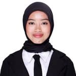
Novika Suryati
Geodetic Engineering Graduate | GIS Analyst | Remote Sensing | Geospatial Data Analysis | Surveying and Mapping | AK3U BNSP Certified
About
Experience
GIS and Remote Sensing Analyst
Bappeda Provinsi Jawa Tengah · internship
Jan 2025 – Feb 2026 · 1 yr 1 mo · Semarang, Jawa Tengah
Analyzed Sentinel-2A imagery (2021-2024) across 8 coastal subdistricts in Demak and Jepara for the Central Java Integrated Coastal Zone Management Masterplan, achieving over 80% overall accuracy in LULC classification. Produced 4 LULC maps (1:25,000 to 1:50,000) and 1 shoreline change map that were adopted as official outputs supporting coastal management planning. Conducted shoreline change assessment using the Digital Shoreline Analysis System (DSAS) with End Point Rate (EPR) and Linear Regression Rate (LRR), identifying change rates from -4 to +6 m/year. Compiled data visualizations and a technical report that served as a reference for the masterplan draft.
Cadastral Survey Intern
KJSB Febrian Bayu · internship
Jan 2024 – Feb 2024 · 1 mo · Tegal, Jawa Tengah
Contributed to mapping approximately 800 land parcels in Capar Village, Tegal Regency, using GNSS RTK and cadastral field surveys under the Complete Systematic Land Registration (PTSL) program, supporting land certificate issuance. Prepared and verified land administration documents (Gambar Ukur, Surat Ukur, Peta Bidang Tanah) in AutoCAD Map 3D, and compiled parcel data recapitulation in Microsoft Excel in line with national cadastral standards. Performed field verification and quality control on survey outputs to ensure positional accuracy and data consistency before submission.
Projects & Portfolio
Comparative Analysis of Maximum Likelihood and CNN Methods for Benthic Habitat Mapping Using Sentinel-2A Imagery (Menjangan Besar Island, Karimunjawa, Central Java)
Developed a deep learning CNN on Google Colab using Python (TensorFlow, GeoPandas) and compared it with Maximum Likelihood Classification (SNAP, QGIS) for benthic habitat mapping on Sentinel-2A imagery. Trained the CNN on 4,625 image patches from three islands after sun glint and water column corrections, reaching 88% accuracy and 95.3% mAP on test data. Validated both methods against 30 field survey points (MLC 83%, CNN 70%), both exceeding the SNI 7716:2011 threshold of 60%.
Disaster Vulnerability Reduction in Gulon Village Facing Mount Merapi Hazards
Coordinated 22 students to assess disaster risk and vulnerability across 25 hamlets through field surveys, interviews, and FGDs under the DRR framework for Mount Merapi eruption mitigation. Led hazard mapping and network analysis in ArcGIS and QGIS, designing 13 evacuation routes linking 13 assembly points to 6 temporary shelters, which were handed over to village officials for evacuation planning. Contributed to a WebGIS platform for hazard zones and evacuation routes (jalurevakuasigulon.com) and delivered evacuation map socialization and assembly point signage.
Intregrated Coastal Area Management in Central Java
Supported the Masterplan of Integrated Coastal Area Management for Bappeda Central Java, providing spatial insights for sustainable coastal development and regional planning along the northern and southern coasts. Classified land cover and digitized shoreline changes for 2021-2024 across multiple coastal districts using Sentinel-2 imagery and GIS, then ran DSAS to assess erosion and accretion trends. Assisted in ground-check validation during field visits to selected coastal locations. Contributed thematic maps and coastal condition reports to the masterplan documentation, and worked with a multidisciplinary team to turn geospatial findings into regional planning recommendations.
Skills & Endorsements
Education
Bachelor Degree
Diponegoro University · Geodetic Engineering
Aug 2022 – Jun 2026
GIS Software Proficiency
Honors & Awards
Cumlaude Graduate
Diponegoro University · 2026-06-22
Graduated with Cum Laude honors from the Bachelor's Degree program in Geodetic Engineering, Faculty of Engineering, Universitas Diponegoro, with a final GPA of 3.57/4.00.
Volunteering
Head of Consumption Division
Imade Undip and SADC Unnisula · Environment
Aug 2023 – Aug 2023
Planned, organized, and oversaw all food and beverage needs for Go Green, a collaborative event between Imade Undip and SADC Unnisula. Coordinated a team to ensure timely meal preparation and distribution to participants.
Public Relation
Novoclub Batch 2 by Paragon Corp · Education
Feb 2023 – Oct 2023
Selected as 1 of 8,216 participants out of 32,000+ applicants for Paragon Novo Club Batch 2. Joined the Good Leader, Good Teacher social project as a Public Relations Division member. Facilitated a 5+ hour interactive learning session for 25+ third-grade students at MI Roudlotul Huda on self-confidence and dream-building, using games, gift-giving, and a “wish tree” activity.
Courses
Basic GIS Training
Precision Field Academy · 2026-09-08
Organizations
Himpunan Mahasiswa Teknik Geodesi
Head of Public Relation · Active Member
Nov 2024 – Jul 2025
Himpunan Mahasiswa Teknik Geodesi
Junior Staff of Public Relation · Active Member
Feb 2024 – Nov 2024
Senat Mahasiswa Fakultas Teknik
Secretary · Active Member
Dec 2023 – Dec 2024
Ikatan Mahasiswa Demak (IMADE) Undip
Junior Staff of Community Social · Active Member
Mar 2023 – Jan 2024
Senat Mahasiswa Fakultas Teknik
Staff of Legislative Agency and Commission 1 · Active Member
Jan 2023 – Dec 2023
Languages
Novika Suryatihasn't published any blog posts yet.