Title: Mapping Pakistan’s Physical Relief & Hydrology: A GIS Approach
Introduction:
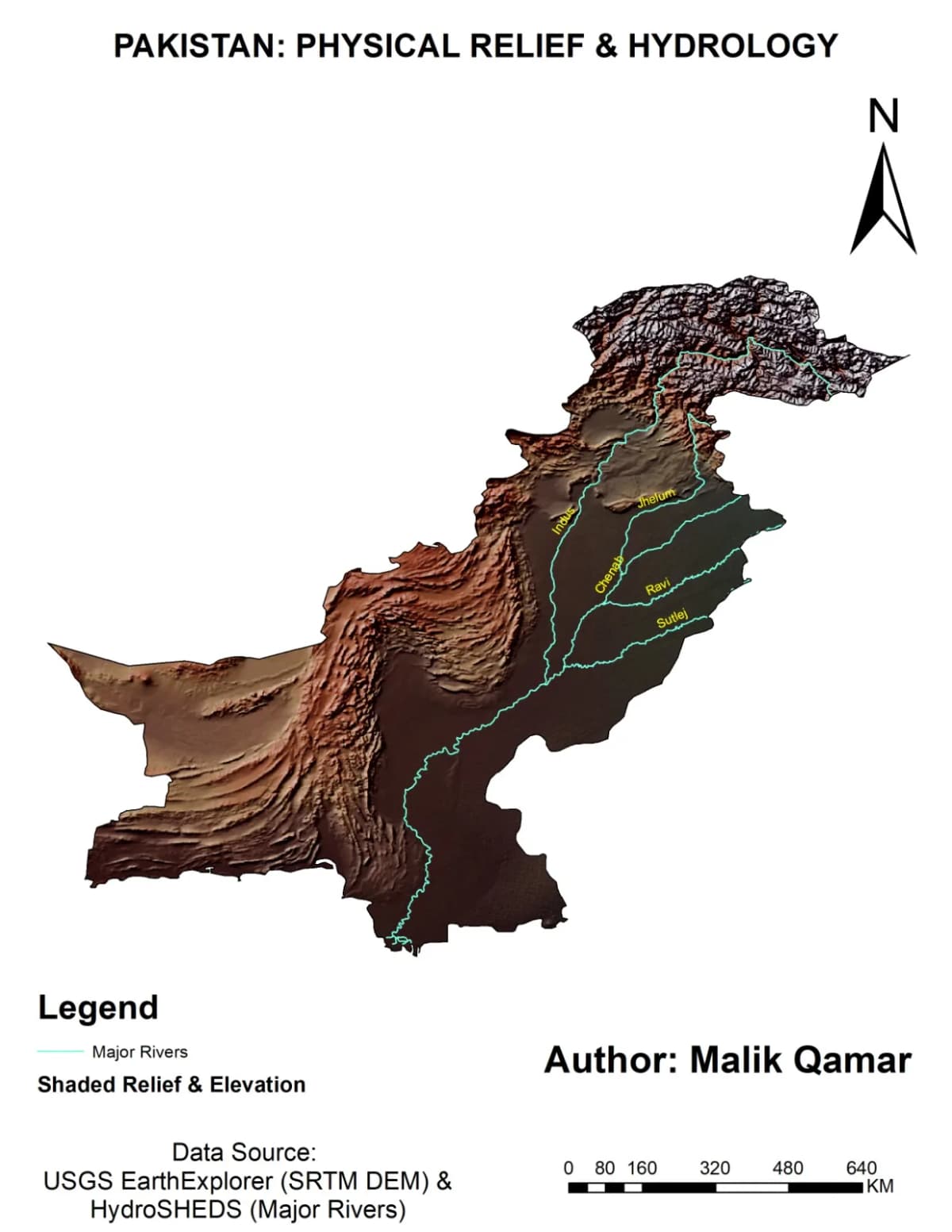
In this project, I aimed to visualize Pakistan’s complex topography and river networks in a single, comprehensive map. Terrain rendering plays a vital role in understanding how geography shapes hydrological systems, and bringing this out visually was an exciting challenge.
Tools & Data Used:
Software: ArcGIS
Data Type: Digital Elevation Model (DEM) combined with hydrographic vector layers to highlight major river basins and drainage patterns.
Key Highlights:
Northern Mountains Depth: Focused heavily on hillshade and elevation symbology to bring out the dramatic relief of the northern ranges.
Hydrology Integration: Overlaying the river network helps visualize how water bodies flow naturally through the varied terrain contours of the region.
Conclusion:
Creating terrain models like this helps bridge raw geographic data with impactful visual storytelling. I’m glad to share this milestone and look forward to refining future iterations with more detailed elevation scales and source citations.