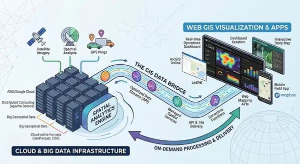
If you’ve spent any part of your GIS career staring at a progress bar while a 10 GB satellite image downloads, you know the pain of traditional data workflows. Moving your shapefiles and GeoTIFFs to an Amazon S3 bucket or Google Cloud Drive doesn't fix this—it just changes where the files sit. The real shift happening in our industry isn't about where we store data, but how the data is structured to be read over the internet.
This is the core of cloud-native geospatial. Instead of downloading an entire dataset just to clip out a single county, cloud-native formats allow your software to request only the specific bytes of data needed to render that exact area.
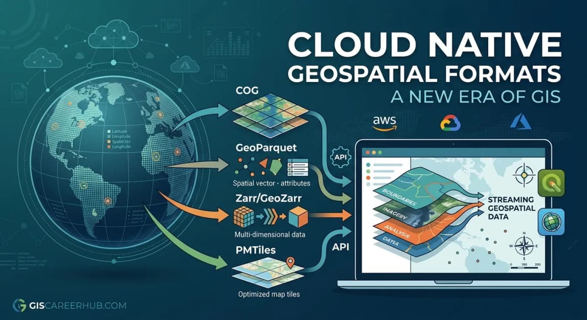
Cloud-native formats stream specific chunks directly to your tools. Source: Cloud-Optimized Geospatial Formats Guide
The Formats Changing the Industry
The foundation of this shift relies on specialized file types that are rapidly becoming industry standards.
Cloud Optimized GeoTIFF (COG): Think of this as a regular GeoTIFF, but mathematically reorganized. The pixels are grouped into internal tiles, and the file contains a built-in pyramid of lower-resolution overviews. When you zoom into a map, your GIS software uses HTTP range requests to grab only the tiles visible on your screen.
GeoParquet: Traditional vector formats like shapefiles read data row by row. GeoParquet is a columnar format. If you only need to analyze the geometry and the "population" column of a dataset, GeoParquet only reads those specific columns, ignoring the rest. It also includes native spatial indexing, allowing query engines to skip massive chunks of the file that don't intersect your study area.
PMTiles: This is a single-file archive for tiled data (vector or raster). Traditionally, serving interactive web maps meant running and paying for a dedicated tile server. PMTiles allows you to host fully interactive, zoomable web maps directly from a cheap cloud storage bucket—completely serverless.
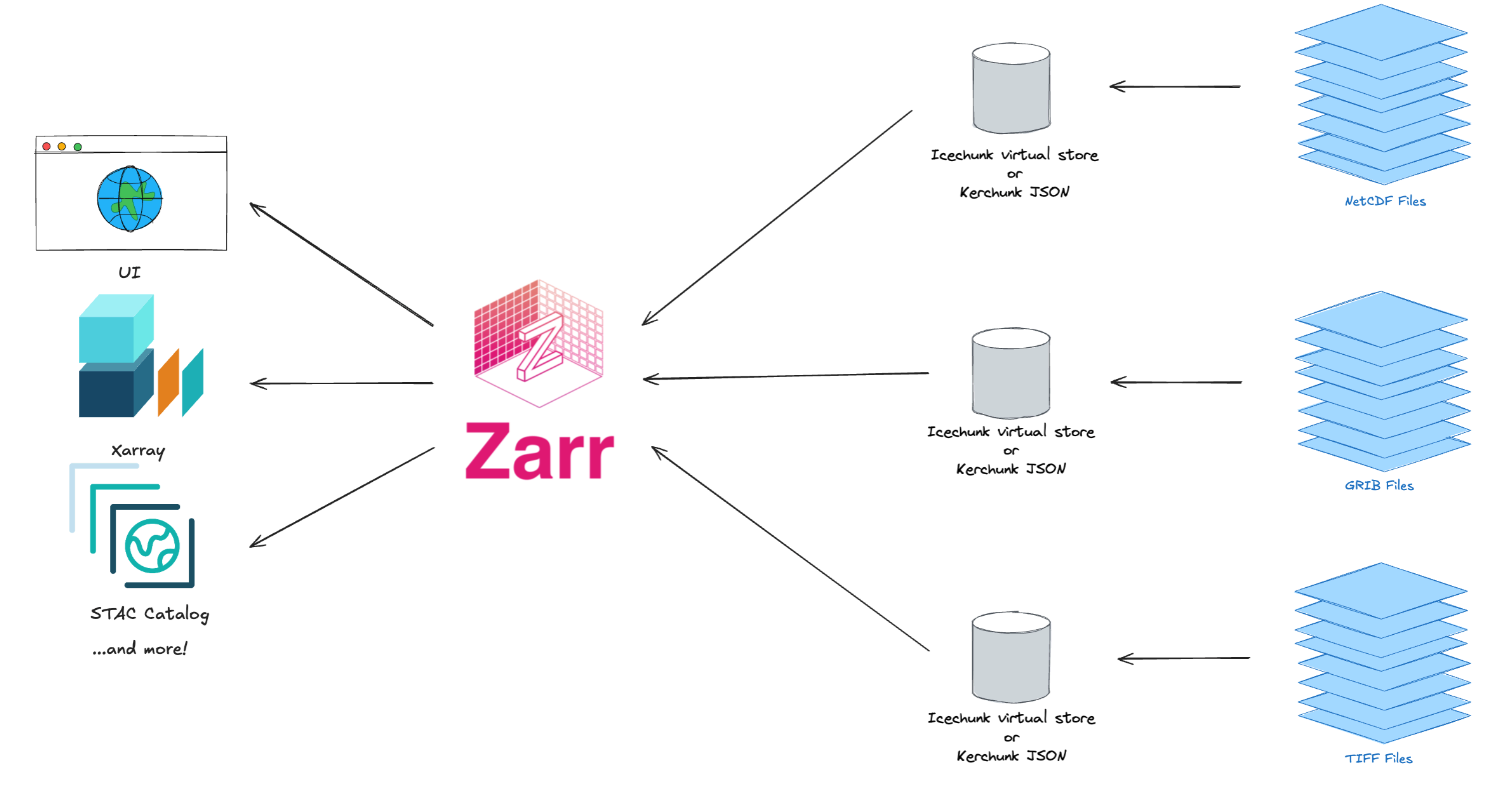
Zarr & GeoZarr: While COGs are great for 2D imagery, climate and meteorological data usually have multiple dimensions (like time, depth, and atmospheric pressure). Zarr is an open standard that stores these massive, multi-dimensional arrays by breaking them into smaller compressed "chunks". GeoZarr takes this a step further by adding standardized geospatial metadata. This means your tools instantly understand the coordinate reference systems and spatial dimensions of the Zarr arrays, making it incredibly fast to stream complex climate models directly from the cloud.

Zarr breaks complex data into chunks for direct cloud streaming. Source: Medium / Zarr — Cloud Native Geospatial Data Format | by Abdishakur
What This Means for Your Career
For GIS professionals, adapting to cloud-native workflows is quickly moving from a "nice-to-have" to a core requirement. The bottleneck is no longer computing power; it’s data movement. By keeping the data in the cloud and bringing the compute directly to it, you can run spatial analysis across thousands of files simultaneously.Learning to work with libraries like Xarray for Zarr datasets, spatial SQL for GeoParquet, and STAC (SpatioTemporal Asset Catalog) APIs for discovering data will set you apart from analysts who rely solely on desktop geoprocessing tools. The era of the monolithic desktop GIS isn't dead, but the most scalable, cost-effective work is now happening natively in the cloud.
Where to Go From Here
If you are ready to dive deeper into this ecosystem and start building your own modern data pipelines, I highly recommend exploring the Cloud-Native Geospatial Guide. It is an incredible, community-driven platform packed with open-source tutorials, technical breakdowns, and best practices for modernizing your spatial infrastructure.
The future of GIS is no longer about managing local files—it's about streaming insights directly from the cloud. Make sure your skills are ready for the shift.