This article was written with the help of AI and is intended to help GIS and WebGIS professionals, students, and developers think through where the field is heading and how to prepare for it.
GIS Careers Are Changing
The U.S. Bureau of Labor Statistics projects employment for cartographers and photogrammetrists to grow 6 percent between 2024 and 2034, faster than the average for all occupations. Surveying and mapping technicians are projected to grow 5 percent over the same period. Neither number is dramatic on its own, but look at what the actual job postings inside that growth are asking for. They are not asking for someone who can click through a desktop mapping workflow. They are asking for people who understand spatial databases, can write Python automation, know how vector tiles are built, and have some exposure to machine learning applied to geographic data.
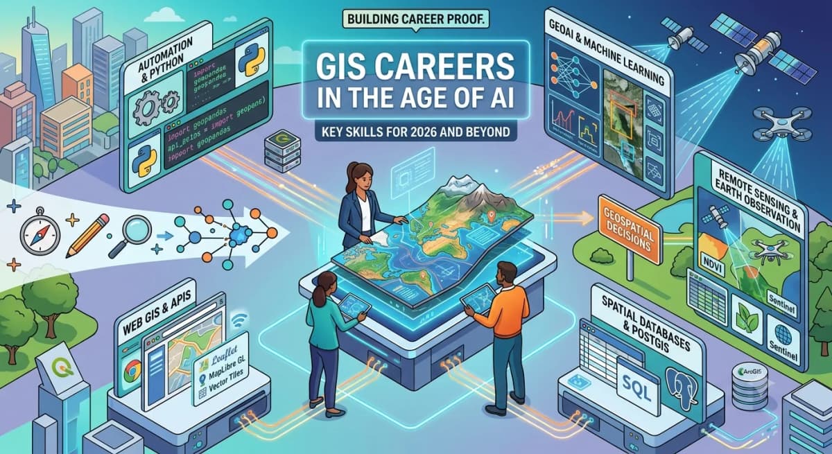
For decades, the life of a GIS professional was largely defined by desktop mapping tools. Today, the field is shifting toward automation, web platforms, remote sensing, real time data integration, spatial databases, and AI supported workflows.
GIS is not disappearing because of artificial intelligence. Geospatial work is becoming more technical, more driven by data, and more interdisciplinary.
Why Traditional GIS Skills Are No Longer Enough
A standard GIS skillset used to revolve around map production, digitizing, basic spatial analysis, desktop workflows, attribute table editing, and cartography.
These skills are still useful. They are the foundation now, not the full career path. Modern GIS roles expect practitioners to understand data pipelines, work with APIs, write automation scripts, use cloud platforms, manage spatial databases, and apply domain specific decision making. If your expertise begins and ends with clicking through software menus, standing out in the current market gets harder every year.
Why This Matters for Your Career
This is not an abstract industry trend. It shows up directly in what gets a candidate shortlisted. Two GIS analysts with the same years of experience will get very different offers if one of them can only produce maps and the other can also query a spatial database, build a small API, or automate a workflow that used to take a day of manual editing. Understanding where the field is moving lets you decide what to learn next instead of reacting to job descriptions you cannot meet.
What AI Means for GIS Professionals
GeoAI, the fusion of machine learning with geospatial data, is being used to classify satellite imagery, detect land use changes, extract roads and building footprints, automate repetitive mapping tasks, and support spatial decision making.
AI helps GIS professionals move faster. It does not remove the need for a foundational understanding of geography and data.
In 2023, researchers Zhenlong Li and Huan Ning published Autonomous GIS: the next generation AI powered GIS in the International Journal of Digital Earth. Their prototype, LLM Geo, used GPT 4 as a reasoning core to generate and execute geoprocessing workflows from natural language prompts on its own. The results were promising, and the limitations were real. The field still faces open challenges around correctness, ethical use, and reliability in production environments.
AI can automate parts of the job. Professionals who understand geography, data quality, map projections, scale, and spatial context remain hard to replace.
Required Tools and Skill Stack
Before going layer by layer: the right tool depends on your organization. ArcGIS holds a dominant position in government, defense, and enterprise environments with existing Esri infrastructure, and that is a legitimate reason to prioritize it. The open source stack, meaning QGIS, PostGIS, and Python, offers more flexibility at lower cost and has become standard in startups, NGOs, and research teams. Both paths are valid. The underlying spatial concepts transfer between them either way.
Core GIS Foundations
Coordinate systems and projections
Spatial analysis and statistics
Cartography and visual hierarchy
Data quality assessment
Geodatabase design and management
Programming and Automation
Python (the industry standard)
GeoPandas and Shapely for spatial data manipulation
Rasterio and GDAL for raster processing
PyQGIS and ArcPy for desktop automation
Spatial Databases
PostgreSQL with the PostGIS extension
Spatial SQL syntax
Spatial indexing strategies
High performance location based queries
Web GIS
JavaScript mapping libraries (Leaflet, MapLibre GL, OpenLayers, deck.gl)
Working with REST APIs
Vector tiles: creating and serving PMTiles and MBTiles, understanding PostGIS ST_MVT and related tiling functions
Interactive dashboards and geospatial web apps
Remote Sensing and Earth Observation
Sentinel and Landsat data workflows
Image classification and feature extraction
Change detection over time
NDVI (a spectral index measuring vegetation health and density) and other environmental indices
Cloud masking and atmospheric correction
AI and Data Science
Machine learning basics (scikit learn, classification, regression)
Computer vision for imagery, including object detection models like YOLO
Annotation and labeling workflows using tools like Roboflow
Spatial feature engineering
Model evaluation metrics
Applied GeoAI workflows
A 2026 preprint from Munir et al., Agentic AI for Remote Sensing: Technical Challenges and Research Directions, lays out why this layer is hard in practice. Earth observation pipelines depend on correct reprojection, resampling, compositing, aggregation, temporal validity, and physical consistency. A generic AI agent does not solve these by default. They require someone who understands the domain. The strongest professionals combine that domain knowledge with automation, databases, web tools, and AI literacy.
How GIS Job Roles Are Evolving
Job titles and expectations are shifting alongside the technology stack. Boundaries are not rigid, and titles vary between organizations, but the general direction is consistent across job boards and hiring conversations.
Where Roles Are Coming From | Where They Tend to Move |
|---|---|
GIS Technician | Spatial Data Specialist |
GIS Analyst | Spatial Data Analyst |
Cartographer | Geospatial Visualization Specialist |
Remote Sensing Analyst | Earth Observation Analyst, GeoAI Analyst |
GIS Developer | Web GIS Engineer, Spatial Platform Engineer |
GIS Manager | Geospatial Product Lead, Spatial Data Lead |
Not every GIS professional needs to become a software developer. Every professional should have a clear sense of which direction they are heading, whether that is analysis, development, remote sensing, data engineering, visualization, or management, and build toward it deliberately.
What Employers Are Really Looking For
Employers are not just looking for "software users" anymore. They want problem solvers who can:
Understand and define complex spatial problems
Clean, validate, and structure messy data
Build reproducible, automated workflows
Communicate insights clearly to non technical stakeholders
Use tools beyond a single proprietary software package
Quickly learn and adapt to new geospatial technologies
Connect GIS work to tangible business, environmental, urban planning, or public sector outcomes
How GIS Professionals Can Prepare
You do not need to learn everything at once. Focus based on your current career stage.
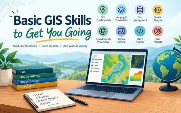
Beginner GIS Professionals should focus on QGIS or ArcGIS fundamentals, coordinate systems, map design, basic Python scripting, and a few solid portfolio projects.
Mid Level GIS Analysts should add PostGIS, automation workflows, web maps, remote sensing basics, and dashboard and reporting skills to their toolkit.
Advanced GIS Professionals should move toward spatial data engineering, cloud architecture, GeoAI implementation, API development, managing large scale geospatial systems, or deep domain specialization.
Pick one direction and build proof through projects rather than trying to cover everything.
Real World Use Case: Building Career Proof Through Portfolio Projects
A strong GIS portfolio demonstrates real spatial problem solving, not screenshots of maps. Match your projects to where you are in your career and where you are trying to go.
For Beginners
Python Script for Automated GIS Data Cleaning Build a script that reads a raw shapefile, fixes invalid geometries, reprojects to a standard CRS, and exports a clean output. This proves you can write code, handle real data issues, and automate a task most GIS professionals still do by hand. Skills demonstrated: Python, GeoPandas, Shapely, coordinate reference systems, file format conversion
Choropleth Map Dashboard with Filtering Use a public dataset, such as census data or environmental readings, and build an interactive web map that lets users filter by region or category. Skills demonstrated: Web GIS basics, Leaflet or MapLibre GL, GeoJSON, basic JavaScript
For Mid Level Analysts
Land Use Change Detection Using Sentinel Imagery Pull two Sentinel 2 scenes from different years for the same area and compare land cover using NDVI or a simple classification. Document your process with before and after outputs. Skills demonstrated: Remote sensing, raster processing, image classification, Python or QGIS
PostGIS Location Query API Build a backend that accepts a latitude and longitude and returns nearby features from a PostGIS database, ordered by distance. This is a core pattern used in real geospatial products. Skills demonstrated: PostgreSQL, PostGIS, spatial indexing, ST_DWithin, basic API development
For Advanced Professionals
Object Detection on Satellite Imagery with YOLO Train or fine tune a YOLO model on annotated aerial or satellite imagery, using a tool like Roboflow for labeling, to detect features such as vehicles, buildings, or solar panels. Skills demonstrated: Deep learning, computer vision, annotation workflows, Roboflow, model evaluation
PMTiles Vector Tile Pipeline from PostGIS Build a pipeline that queries PostGIS using ST_MVT, generates vector tiles, packages them as a PMTiles archive, and serves them through a MapLibre GL map. This is increasingly how modern geospatial teams serve large datasets without a tile server. Skills demonstrated: PostGIS ST_MVT, tile generation, PMTiles, MapLibre GL, spatial data engineering
Common Issues and Fixes
Professionals making this transition tend to run into the same handful of problems:
Trying to learn every layer of the stack at once. This usually leads to shallow knowledge everywhere and depth nowhere. Fix: pick one direction from the sections above and go deep before going wide.
Building portfolio projects that only produce a map. A map alone does not show you can solve a problem end to end. Fix: include the data cleaning, the query logic, or the API layer, not just the final visual.
Assuming open source and proprietary tools are in competition. Fix: treat ArcGIS and the QGIS or PostGIS stack as different tools for different organizational contexts, and learn to be comfortable moving between them.
Treating AI tools as a replacement for domain knowledge. An AI assistant can generate a geoprocessing script, but it will not catch a wrong coordinate reference system or a resampling error on its own. Fix: use AI to speed up work you already understand, not to skip understanding it.
Best Practices
Build in public. A GitHub repository with a working PostGIS API or a vector tile pipeline is worth more to a hiring manager than a list of software names on a resume.
Document your process, not just your output. Showing how you handled a messy dataset or a projection mismatch demonstrates judgment, which is what employers are actually screening for.
Keep your core GIS foundations sharp even as you specialize. Coordinate systems, data quality, and spatial reasoning do not go out of date, and they are what let you catch mistakes that automation and AI tools will eventually make.
Revisit your skill stack every year. The tools in the Web GIS and AI layers move fast enough that what was current two years ago may already be a step behind.
Conclusion: Key Takeaways
AI and automation will change geospatial work, but they will not replace the value of understanding how the world is structured spatially and turning that understanding into decisions. The professionals who grow fastest from 2026 onward will combine geography, data, and modern tooling to solve problems that matter.
Three things to act on:
Pick a direction. Analysis, development, remote sensing, data engineering, visualization, or management, rather than trying to master every layer of the stack at once.
Build proof, not credentials. A working PostGIS API or a vector tile pipeline on GitHub demonstrates more than a certificate.
Treat AI as leverage, not a replacement. The people who understand projections, data quality, and spatial context are the ones who can actually use GeoAI tools well, and catch it when they are wrong.
The future of GIS belongs not only to people who can make maps, but to people who can turn spatial data into decisions.